Kearney Planning Commission Meeting - June 21, 2019
STREAMING COPY IN PREPARATION — RECORDING AVAILABLE FROM THE ORIGINAL SOURCE
Kearney Planning Commission Meeting - June 21, 2019
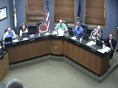
The Kearney Planning Commission met on June 21, 2019 at 9:00 a.m. in City Council Chambers to consider several rezoning, plat, vacation, and land use map amendment applications, as well as approval of revised bylaws and an annual report. All items were approved unanimously with minor conditions.
Consent Calendar
- The commission approved the minutes of the May 17, 2019 meeting by unanimous voice vote.
Discussion Items
- K and S Subdivision (Items 4-6): Mitch Humphrey (Buffalo Surveying Corp.) presented a request to rezone a 4.07-acre tract from AG (Agricultural) to RR-1 (Rural Residential) to allow the Kottmeyer family to split off a lot for their daughter and son-in-law to build a home. The lot would be served by individual well and septic, with access via a 40-foot-wide ingress-egress easement. Staff noted compliance with RR-1 standards and the 2016 Comprehensive Plan. The county planning commission had no objections. The rezoning, preliminary plat, and final plat were each approved unanimously.
- Trampe Estates (Items 7-9): Mitch Humphrey presented a similar request to rezone two lots (totaling 5.2 acres) from AG to RR-2 (Rural Residential, Intermediate Standards) for the Trampe family to convey a lot to their son and daughter-in-law. The property is partially within the city's extraterritorial jurisdiction. Staff recommended approval subject to a certificate of approval from the Nebraska Department of Environmental Quality (NDEQ) prior to city council action. The rezoning, preliminary plat, and final plat were each approved unanimously with that condition.
- Central Avenue Street Vacation (Item 10): Doug Stevenson (Olsson) requested vacation of 17 feet of right-of-way along the west side of Central Avenue (between 1st Street and the canal). Research indicated that a prior vacation had been recorded but never documented, and the street has been accepted at 66 feet. The city requested a utility easement over the vacated 17 feet. The commission approved the street vacation unanimously.
- Fuller and Daley Third Addition (Items 11-17): Paul Brungardt (Brungardt Engineering) and Trent Snow (surveyor) presented a complex series of actions to consolidate two existing lots (Lot 3 of First Addition and Lot 9 of Second Addition) into a new three-lot subdivision for Willis Storage, LLC. The plan included:
- A land use map amendment from Office/Commercial and Commercial Mixed Use to Light Industrial for Lot 3.
- Rezoning of Lot 3 from M-1 (Limited Industrial) to M-1/PD (Planned Development Overlay).
- Vacation of an existing 40-foot access easement on the east side of Lot 1 and creation of a new 40-foot paved ingress-egress easement on the west side.
- Partial vacation of Lot 3 and Lot 9 to allow replatting.
- Approval of preliminary and final plats for the new Fuller and Daley Third Addition.
- Approval of a planned district development plan for a commercial storage facility, with a deviation to permit the 40-foot easement (since city code for M-1 districts does not normally allow access via easement; staff noted the same deviation was previously approved). Staff also suggested a future land use map amendment for the adjacent Lot 9 from General Industrial (GI) to Light Industrial, but this was deferred to a later meeting. All motions passed unanimously.
- Approval of Revised Bylaws (Item 18): The commission adopted revised bylaws with a minor wording change: in Section 9, “a motion may be made to approve or deny said motion or to continue the matter” was revised to “a motion may be made to approve, deny, or continue the matter” by removing “said motion.” Motion passed unanimously.
Public Comments & Testimony
- No public comments were offered on any agenda item.
Key Outcomes
- All six major items (K & S Subdivision, Trampe Estates, Central Avenue vacation, Fuller and Daley Third Addition land use amendment, rezoning, vacations, plats, and development plan) were approved unanimously. The Trampe Estates approval included a condition requiring NDEQ certificate approval before city council action. The Fuller and Daley development plan included a deviation for a 40-foot access easement.
- The commission approved revised bylaws with a textual correction.
- Staff presented a planning commission annual report noting a decrease in overall agenda items but an increase in commercial and industrial development, and highlighted upcoming sign code amendments. The commission discussed its collaborative process and the value of the Development Review Team (DRT) in preparing polished applications.
Meeting Transcript
Copy of the open meeting act is available for review and is posted on the meeting room door or wall. Roll call, please. Rickard? Here. McDermott. Here. Here. Here. Here. Malone. Here. We have a quorum. You all have copies of the minutes of the meeting of May 17th. Um, and have reviewed those. Uh motion would be in order in regards to those. I can make a motion to approve the minutes. Second. Excuse me, it's been moved and approved moved and seconded. Is there any discussion, corrections? Any items of concern in there. Uh Nancy. Fusener? Here or yes. McGinnis. Aye. Rickard? Aye. Aiken. I mcdermott. Aye. Motion carries. Um we have several items on the agenda this morning. I remind you, please, if you could, uh, when your item comes up, please step to the podium here at the center and give us your name and your address. Um, and tell us uh the nature of your um interest here. Likewise, if you're going to comment on anything, we appreciate you. Please come to the center stage here and give us your name and address uh for the record. I remind you also the plan of commission is a recommendative body uh to the city council. Our actions here go on to the council and they take final action. Um the first item that we have item number four, and we're gonna treat four, five, and six together uh because it relate to the same parcel of the property. Uh this includes a rezoning Corqua and S subdivision submitted by Buffalo Survey Incorporation for Mark Mark Cottmeyer and Ellen and Elaine Cottm Cottmeyer, husband and wife to rezone from District A G agricultural district to district RR1, rural residential rural standards for property described as a tract of land being part of the south half of the southwest quarter, section 119th Township 9, North Range 16 West, the 6th principal meridian. Properties located east and adjacent to 8765 17th Avenue. The second uh the fifth and sixth items on the agenda are a hearing for the preliminary and final plates for that same property. Good morning. Good morning. Uh for the record, my name is Mitch Humphrey with Buffalo Surveying Corporation located at 5308 Parkland Drive here in Kearney. And I'm here to represent Mark and Ann Kottmeyer who own the own the property that uh we're discussing today. And essentially what we're doing is taking a portion of the property that they own. Uh there's about 60 acres, I think, uh outlined in the red and and blue on the monitor and partitioning it off. Uh the site is located north of Highway 40, that the intersection of highway 40 and 17th Avenue is right there. Uh the Mark and Ann own a house there, and they have an outbuilding to the east of the house.
openpublica.com