OPENPUBLICA · PUBLIC MEETING RECORD
Record of Proceedings

Huntington Beach Planning Commission Study Session - June 26, 2018
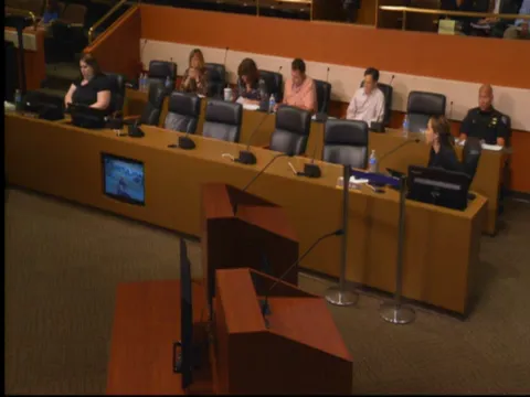
City CouncilTuesday, June 26, 2018
BodyHuntington Beach, California
SessionCity Council
DateTuesday, June 26, 2018
StatusFILED
Video Record

STREAMING COPY IN PREPARATION — RECORDING AVAILABLE FROM THE ORIGINAL SOURCE

Transcript — Verbatim
5:38

And I'll go into a little bit more detail with that in my next slide.

5:43

The project is subject to providing affordable housing, and the applicant has elected to provide the affordable units at an off-site location.

5:51

The project is also subject to the Quimby Act and is required to dedicate a minimum of 0.77 acres of parkland.

5:59

However, 1.15 acres is proposed.

6:01

Lastly, the project will be required to provide a public art component that will be installed within the park area and will be maintained by the HOA.

6:11

The public art will also have to be reviewed by the design review board.

6:17

So just getting into a little bit of the PUD, the applicant is proposing lot widths ranging from 45 T 45 feet to 53 feet in lieu of a minimum of 60 feet wide lots and lot sizes that range between 3,870 square feet to 6,102 square feet in lieu of a minimum of 6,000 square feet.

6:39

A PUD again requires public benefits that are mutually beneficial.

6:44

And as such, the applicant has proposed the following requ benefits.

6:53

Physical park improvements where no and par where no park improvements are required, such as landscape, landscaping, irrigation, playground equipment, picnic tables, and public art.

7:04

Third, uh allowing the public to utilize on street parking uh on private streets for the use of the park.

7:10

And lastly, staff is recommending a monetary contribution of 250,000 dollars toward the Navy Ride of Way Trail Improvements or for other public parks within the vicinity.

7:21

All public all proposed public benefits are subject to the approval by the planning commission.

7:29

So this aerial image is the uh the Navy Ride of Wail.

7:35

The trail is just located south of the site right here.

7:39

It starts at Rancho Road and extends all the way to Springdale Street.

7:44

The site was formerly used as a railroad right-of-way.

7:47

The city is in the process of acquiring the right of way and has future plans of improving it to use as an open space trail.

7:54

Uh, the monetary contribution would be used when the city has full ownership and rights in order to make those physical improvements.

8:01

Um, or alternatively, the monetary contribution can go toward other park and recreational uses as needed.

8:10

Um, so there are two discrepancies with the methodologies for the measurement of the park area.

8:16

First, um, the existing park acreage included the sidewalk and parkway because the improvements to the sidewalk and parkway were done when the city first installed the park back in the 1960s.

8:28

The existing parkland acreage listed in the general plan as well as the park and recreation master plan includes that those areas and is listed as 1.52 acres.

8:40

Um, however, the most recent measurement of the park shows that the parkland, including the sidewalk and parkway, is actually 1.40 acres.

8:48

Therefore, the city's listed park acreage is inaccurate.

8:52

The proposed subdivision map does not include the adjacent sidewalk and parkway for the dedication.

8:58

And to clarify the discrepancies, the proposed park dedication acreage will be compared to the existing park acreage, which would exclude the sidewalk and parkway, and the existing park acreage without the sidewalk and parkway is approximately 1.3 acres.

9:21

And when comparing the existing park and the proposed park without the sidewalk and parkway, the actual reduction is one is 0.15 acres.

9:40

So on the column on the left are the measurements uh that are from back of curb, which includes the sidewalk and parkway, and the column on the right um has the figures that uh exclude the parkway and the sidewalk.

9:53

So the existing park uh again is 1.40 acres, and there's an asterisk there.

10:00

The footnotes says that it's inaccurately listed as 1.52 acres.

10:06

And the existing park excluding the sidewalk and parkway is 1.3 acres.

10:12

So if we're comparing the numbers, the proposed park is 1.15 acres, excluding the parkway, and again that difference in area is 0.15 acres.

10:27

The site plan shows the existing park area, which excludes the sidewalk and parkway.

10:34

And there's an overlay on it showing the proposed park to compare the existing versus the proposed.

10:41

As you can see, the existing park is in a linear design, and the proposed parkway is in a more of a rectangular design.

10:49

And again, the difference in acreage is 0.15 acres.

10:56

So this aerial image is showing the boundary of Franklin Park, which is in the green overlay section here.

11:03

The remainding area of the open school field is located just south of the park and is approximately 3.2 acres.

11:11

However, the city does not identify that school field as parkland and it's not counted in the city's park land park inventory.

11:21

So the project is subject to the Quimby Act and is required to dedicate parkland because there are more than 50 parcels.

11:30

The area of parkland that is required for dedication is based on a formula that involves the density factor and the number of dwelling units.

11:37

And as such, the project is required to dedicate 0.77 acres.

11:41

The Quimby Act does not require park improvements, such as the installation of landscaping irrigation, and as previously mentioned, the applicant is providing those improvements as a mutual public benefit.

11:53

The park is located on the northeast section of the proposed project site, and access is maintained along Sands Drive, which is how the existing park is currently accessed.

12:02

And lastly, the community services commission reviewed the proposed park improvements and recommended approval to the city council.

12:11

So the park will be fully landscaped with irrigation.

12:14

There will be a pedestrian walkway on the north and south side of the park.

12:19

There is a proposed tot lot in the center, some trellis structures and bench seating along that top lot area, and there are some proposed picnic tables with shade trees in this corner of the park.

12:35

The existing conditions, there's currently an outdated totlot area along Hammonds and Hammond and Sands Drive here, and on the east side are a couple of picnic tables here with some landscaping and trees in between both areas.

12:52

The proposed park amenities include updated totlots, and the applicant has provided two different options.

13:12

Updated park amenities also include enhanced landscaping, such as a butterfly garden with drought tolerant plants and shrubs, trees, park benches, picnic tables, and the proposed public art is a mosaic beach ball design.

13:48

And the two-story projects will be sited within the interior of the interior of the tract.

13:55

The project will provide for four-foot-wide sidewalks, five-foot wide landscape parkways, and 38 feet wide private streets, which meet fire department access requirements.

14:06

And the proposed private streets and sidewalks will align with the existing streets and sidewalks to ensure consistency and a continuous network for pedestrian and vehicular travel.

14:27

The project is consistent with the city's urban design guidelines for single family residences as the homes create visual interest and varies in designs at BAX Heights and incorporates a variety of materials such as tile, window trims, and shutters, siding, and stone veneer.

14:47

On March 28th, the environmental assessment committee reviewed the approved processing of a mitigated negative declaration or MND for the proposed project.

15:00

The M and D analyze environmental factors and staff finds that less than significant impacts with mitigations will occur for aesthetics, biological resources, cultural resources, and tribal cultural resources.

15:09

The M and D was made available to the public for review for a period of 20 days in accordance with the California Environmental Quality Act.

15:17

Staff received several public comments regarding environmental issues and has repaired res prepared response to comments, which will be included in the attachment to the public hearing staff report.

Discussion Breakdown — Share of Meeting
Planning and Zoning█████████████████████████████████33%
Public Comments██████████████████████████████30%
Procedural████████████12%
Parks and Recreation███████████11%
Public Engagement██████6%
Public Safety███3%
Public Works███3%
Affordable Housing██2%
Summary of Proceedings

Huntington Beach Planning Commission Study Session - June 26, 2018

The Huntington Beach Planning Commission held a study session on June 26, 2018, beginning at 5:15 PM in the Council Chambers. The purpose of the session was to introduce and discuss the proposed Sea Dance Residential Development project. Commissioners present were John Scandura (Chair), Pat Garcia (Vice Chair), Bill Crowe, Alan Ray, and Michael Grant. Commissioners Dan Kalmick and Connie Mandic were absent. No formal action was taken during the study session, which concluded with closing remarks and adjournment.

Consent Calendar

  • No consent calendar items were presented.

Public Comments & Testimony

  • No public comments were received.

Discussion Items

  • Study Session Item: General Plan Amendment No. 16-001, Zoning Map Amendment No. 16-002, Tentative Tract Map No. 18147, Conditional Use Permit No. 16-031, Mitigated Negative Declaration No. 16-002 (Sea Dance Residential Development) – The project proposes to change land use and zoning designations from Public and Public-Semipublic to Residential Low Density and Open Space Park, and to subdivide the former Franklin School site at 14422 Hammon Lane into 53 single-family residences within a Planned Unit Development. Jessica Bui, Associate Planner, presented the staff overview and analysis of environmental impacts. Commissioners discussed the proposal but took no vote, as the study session was intended for informational and deliberative purposes only.

Key Outcomes

  • The study session was held to introduce the Sea Dance project; no motions or formal actions were made.
  • The regular meeting scheduled for 7:00 PM was cancelled.
  • The commission acknowledged the return of Commissioner Crowe and expressed well wishes for the absent Commissioner Mandic.
  • The study session was adjourned; the next regular Planning Commission meeting is scheduled for July 10, 2018, at 7:00 PM.

Meeting Transcript

And I'll go into a little bit more detail with that in my next slide. The project is subject to providing affordable housing, and the applicant has elected to provide the affordable units at an off-site location. The project is also subject to the Quimby Act and is required to dedicate a minimum of 0.77 acres of parkland. However, 1.15 acres is proposed. Lastly, the project will be required to provide a public art component that will be installed within the park area and will be maintained by the HOA. The public art will also have to be reviewed by the design review board. So just getting into a little bit of the PUD, the applicant is proposing lot widths ranging from 45 T 45 feet to 53 feet in lieu of a minimum of 60 feet wide lots and lot sizes that range between 3,870 square feet to 6,102 square feet in lieu of a minimum of 6,000 square feet. A PUD again requires public benefits that are mutually beneficial. And as such, the applicant has proposed the following requ benefits. Physical park improvements where no and par where no park improvements are required, such as landscape, landscaping, irrigation, playground equipment, picnic tables, and public art. Third, uh allowing the public to utilize on street parking uh on private streets for the use of the park. And lastly, staff is recommending a monetary contribution of 250,000 dollars toward the Navy Ride of Way Trail Improvements or for other public parks within the vicinity. All public all proposed public benefits are subject to the approval by the planning commission. So this aerial image is the uh the Navy Ride of Wail. The trail is just located south of the site right here. It starts at Rancho Road and extends all the way to Springdale Street. The site was formerly used as a railroad right-of-way. The city is in the process of acquiring the right of way and has future plans of improving it to use as an open space trail. Uh, the monetary contribution would be used when the city has full ownership and rights in order to make those physical improvements. Um, or alternatively, the monetary contribution can go toward other park and recreational uses as needed. Um, so there are two discrepancies with the methodologies for the measurement of the park area. First, um, the existing park acreage included the sidewalk and parkway because the improvements to the sidewalk and parkway were done when the city first installed the park back in the 1960s. The existing parkland acreage listed in the general plan as well as the park and recreation master plan includes that those areas and is listed as 1.52 acres. Um, however, the most recent measurement of the park shows that the parkland, including the sidewalk and parkway, is actually 1.40 acres. Therefore, the city's listed park acreage is inaccurate. The proposed subdivision map does not include the adjacent sidewalk and parkway for the dedication. And to clarify the discrepancies, the proposed park dedication acreage will be compared to the existing park acreage, which would exclude the sidewalk and parkway, and the existing park acreage without the sidewalk and parkway is approximately 1.3 acres. And when comparing the existing park and the proposed park without the sidewalk and parkway, the actual reduction is one is 0.15 acres. So on the column on the left are the measurements uh that are from back of curb, which includes the sidewalk and parkway, and the column on the right um has the figures that uh exclude the parkway and the sidewalk. So the existing park uh again is 1.40 acres, and there's an asterisk there. The footnotes says that it's inaccurately listed as 1.52 acres. And the existing park excluding the sidewalk and parkway is 1.3 acres. So if we're comparing the numbers, the proposed park is 1.15 acres, excluding the parkway, and again that difference in area is 0.15 acres. The site plan shows the existing park area, which excludes the sidewalk and parkway. And there's an overlay on it showing the proposed park to compare the existing versus the proposed. As you can see, the existing park is in a linear design, and the proposed parkway is in a more of a rectangular design. And again, the difference in acreage is 0.15 acres. So this aerial image is showing the boundary of Franklin Park, which is in the green overlay section here. The remainding area of the open school field is located just south of the park and is approximately 3.2 acres. However, the city does not identify that school field as parkland and it's not counted in the city's park land park inventory. So the project is subject to the Quimby Act and is required to dedicate parkland because there are more than 50 parcels. The area of parkland that is required for dedication is based on a formula that involves the density factor and the number of dwelling units. And as such, the project is required to dedicate 0.77 acres. The Quimby Act does not require park improvements, such as the installation of landscaping irrigation, and as previously mentioned, the applicant is providing those improvements as a mutual public benefit. The park is located on the northeast section of the proposed project site, and access is maintained along Sands Drive, which is how the existing park is currently accessed. And lastly, the community services commission reviewed the proposed park improvements and recommended approval to the city council. So the park will be fully landscaped with irrigation. There will be a pedestrian walkway on the north and south side of the park. There is a proposed tot lot in the center, some trellis structures and bench seating along that top lot area, and there are some proposed picnic tables with shade trees in this corner of the park. The existing conditions, there's currently an outdated totlot area along Hammonds and Hammond and Sands Drive here, and on the east side are a couple of picnic tables here with some landscaping and trees in between both areas.

SUMMARIZED BY OPENPUBLICA AI
TRANSCRIPT VIA PUBLIC VIDEO
openpublica.com