Kearney City Council Meeting - March 14, 2023: Arbor View Second Development, 30th Avenue Feasibility Study
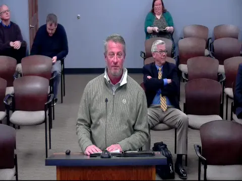
STREAMING COPY IN PREPARATION — RECORDING AVAILABLE FROM THE ORIGINAL SOURCE
Kearney City Council Meeting – March 14, 2023
The Kearney City Council met on March 14, 2023, at 5:30 p.m. in Council Chambers. The meeting focused on the proposed Arbor View Second subdivision, including rezoning, plat approval, and annexation, as well as a presentation on a feasibility study for a potential west I-80 interchange via 30th Avenue. Several community members voiced concerns about traffic density and drainage.
Consent Calendar
- Approved minutes of February 28, 2023.
- Approved claims.
- Accepted bids for Snow Removal Equipment at Kearney Regional Airport: a carrier vehicle and snow broom attachment for $733,705.00, and a carrier vehicle/liquid spreader with snowplow for $645,036.00 (both awarded to M-B Companies, Inc.).
- Adopted Resolution No. 2023-46 to enter the Nebraska CLASS Trust.
- Approved Change Order No. 7 for Yanney Heritage Park Pavilion and Parking Lot ($1,348.00 increase) and Change Order No. 1 for 2022 Part 4 Improvements on 31st Street ($60,280.00 increase).
- Authorized letters of no recommendation for Casey’s General Store manager applications (six locations) and for Nebraska Ale Works liquor license and manager application.
- Awarded contract for Kearney Cemetery Road Replacement to S & J Construction ($49,299.25).
- Approved purchase of a Bobcat Skid Steer Loader and grapple for the Sanitation Department ($54,201.02).
- Adopted Resolution No. 2023-49 for an agency agreement with NDOT Aeronautics Division.
- Approved Ordinance No. 8625 amending the salary ordinance, repealing Ordinance No. 8619.
Public Comments & Testimony
- Dan Lindstrom (attorney for neighboring landowners) expressed concerns about the density of the proposed R2 zoning, citing traffic safety with only one exit. He compared units-per-exit ratios from other subdivisions (e.g., Eastbrook: 83 units/exit; Stone Ridge: 25; Remington: 44; Arbor View: 93 units/exit with phase one and two, potentially 173 with future phases). He argued the development would overload the single exit at 65th Street and Avenue N.
- Marsha Wilkerson (resident at 1621 East 67th Street) supported the permanent gate at Avenue R from the 2019 agreement but opposed the R2 rezoning due to potential traffic increases. She cited Institute of Traffic Engineers standards (local streets should have ≤1,000 vehicles per day) and estimated 560 trips/day from duplexes and 500 from single-family homes, exceeding the threshold. She also raised concerns about the NRD drainage canal as a safety hazard.
- Dale Madsen (1421 East 67th Street) raised a drainage issue: water no longer flows south from his property due to a berm created during utility installation. He asked if he could tap into the development's drainage system. The City Manager noted this is a civil matter to discuss with the developer.
- Dale King (1540 East 67th Street) opposed R2 due to traffic, noting high speeds on Avenue N and that residents have paid out-of-pocket to repair their county road.
- Dan Engels (4800 Avenue L Place) stated his family owns land east of the development and has no plans to sell, meaning no future road connection to the east. He also warned that the drainage culvert already nears capacity with heavy rain and that additional impervious surface would worsen flooding.
Discussion Items
Arbor View Second Development (Public Hearings 1-6)
- Presentation by Craig (Miller & Associates, representing Fox Creek Development LLC) detailed the proposal: 20.54 acres with 43 lots east of Avenue N, south of 65th Street. The plan includes rezoning 8.26 acres to R1 (single-family) and 12.28 acres to R2 (mixed-density). The developer reduced lots from 49 to 43 and widened R2 lots to ~102 feet to accommodate duplexes or larger single-family homes. An ingress-egress easement for secondary access was included. The developer affirmed no planned development (PD) overlay; existing subdivision agreement requires a traffic signal if warranted. A 75-foot detention cell and 100-foot drainage outfall provide buffers.
- Council members questioned traffic impacts. Council member noted that R2 could allow up to fourplexes, increasing density beyond original R1-only preliminary plat. City staff (Andy) stated that a traffic signal is not currently warranted but may be triggered in future phases. City Manager noted the developer has agreed to pay 50% of a signal if warranted.
- Council discussed the 2019 compromise that closed 67th Street (Avenue R) with a permanent gate for emergency access only. Council member noted that the gate was a necessary compromise but has led to the current traffic challenge.
- Vote on R2 rezoning (Public Hearing 4 – Ordinance 8624): Failed 1-4 (Mayor Nikkila voted no, Council Member Schmidt voted no, Council Member Moore voted no, Council Member Buschkoetter voted no; only Council Member Kotsiopulos voted yes). Consequently, the final plat (Resolution 2023-42) and annexation (Resolution 2023-43) were tabled.
- Votes on other items: All passed unanimously:
- Release of permanent right-of-way and utility easement (Resolution 2023-40): passed.
- Release of storm water detention cell easement (Resolution 2023-41): passed.
- Rezoning to R1 (Ordinance 8623): passed on final reading.
- Public hearings 5 and 6 were closed and resolutions tabled.
30th Avenue Feasibility Study (Regular Agenda Item 1)
- Presentation by Dan Satorius and Mike Olson (Kirkham Michael) presented a feasibility study for a potential west I-80 interchange. Three alternatives were considered: 30th Avenue, 46th Avenue, and a “Cotton Mill Connector.” The 30th Avenue alternative was deemed most feasible due to better compatibility with land use plans, lower environmental impact, fewer property impacts, and lower cost. Key recommendations: extend 30th Avenue south to Talmage Street, extend Talmage Street to 30th Avenue (already in city plans), and widen the 30th Avenue overpass to four lanes. The goal is to reduce traffic on 2nd Avenue and open western Kearney for development. Council members expressed support for continuing the planning process but noted no immediate commitment to funding.
Open Account Claim to NPPD (Regular Agenda Item 2)
- Approved an open account claim to Nebraska Public Power District in the amount of $7,590.10.
Key Outcomes
- R2 Rezoning Failed (Ordinance 8624): defeated 1-4, leaving the property zoned AG for that portion.
- R1 Rezoning Approved (Ordinance 8623): passed unanimously on final reading.
- Easement Releases Approved (Resolutions 2023-40 and 2023-41): passed unanimously.
- Final Plat and Annexation Tabled (Resolutions 2023-42 and 2023-43): tabled pending resolution of zoning issue.
- Consent Agenda and Consent Ordinance Approved as listed.
- 30th Avenue Feasibility Study: Council received the report and expressed intent to continue planning, with potential adoption of a resolution supporting future pursuit (discussed but not voted).
- Next Steps: Staff to consider initiating a traffic study for the Arbor View area; developer and neighbors to address drainage concerns privately.
Meeting Transcript
Well, good evening, everyone. And welcome to our city council meeting for March 14th. Uh to please rise. We'll have a moment of silence and then we'll have the Pledge of Allegiance. Please join us in the Pledge of Allegiance. I pledge allegiance to the flag of the United States of America. And two modeling for which it stands. One nation individual with liberty and justice for all. Thank you. In accordance with section 84 1412 of the Nebraska revised statutes, a current copy of the open meetings act is available for you. It's post on all the council chambers. Peggy, we take roll, please. Mayor Claus. Here. Bush Cutter. Here. Next more. Here. We have no oral communication, no one finished business. We'll move into public hearings one through six, and they can be discussed together but voted on separately, and they pertain to the development of our review second submitted by Miller Associates for Fox Creek Development LLC. Planning Commission recommended approval. Public hearing one is to consider resolution number 2023-40 releasing as permanent right-of-way and utility easement. Public hearing two is to consider resolution number 2023-41 releasing a stormwater detention cell easement. Public hearing three is to consider ordinance number 8623 rezoning the property to district R1, urban residential, single family district, low density. Public hearing four is to consider ordinance number 8624 rezoning the property to district R2, uh urban residential mixed density district. Public hearing five is to consider resolution number 2023-42 for the final plant and subdivision agreement for RBV second. And public hearing six is considered resolution number 2023-43 for the annexation of Arborview second. Okay. All right, good evening, Mayor and Councilman. So 1111 Central Avenue. I'm here from Miller Associates representing tonight Fox Creek Development LLC. And tonight we'll be going over all the items that you discussed there that are part of the public hearing. So I'll kind of give an overview over the whole project here. So the area that we're looking at we'll be talking about tonight is shown in yellow here. It's east of Avenue N, south of 65th Street. It consists of uh 20.54 acres tonight and has 43 lots on it. Um the area currently right now is zoned A, and we're asking for a portion of it to be zoned R1 and another portion of it to be zoned R2, and the remaining of that that we've already preliminary platted as well, um, would still remain AG at this time. It's currently bordered on the north by R1, and on the south by R1 AG, and on the east by AG as well. The feature land use map shows that this property is low density residential, which is compatible with R1 and R2 according to the uh comprehensive plan and future land use map. To the north of it is LDR, to the south is LDR, to the southeast is MDR, medium density residential, and to the the east is urban rural therapy. This is the 2018 preliminary plant that we had, and um this is what we brought through. It consisted of 159 lots and 66.75 acres. We brought before you already at one point in time, what was known as our reviews first edition, which is located in this area here. That is what we brought through as a final plat in 2019. Consisted of 30 lots. Um they were ordered on the north side of 65th Street. Um, east would be Avenue R, Coldie Sachs of O and P and O there, and then uh we had a detention cell outlaw here with lots on the south as well. So the existing preliminary plant that that we have shows in blue what's currently been platted and what we have right now with the preliminary plant that's effective. We showed R1 lots that would be consistent with 49 lots located in that yellow area. What's being proposed today is that um we take it, we took it from 49 lots to 43 lots.
openpublica.com