Kearney Planning Commission Meeting – September 20, 2019
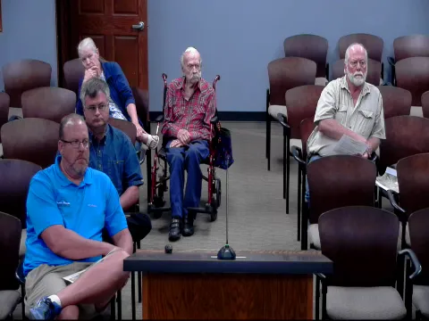
STREAMING COPY IN PREPARATION — RECORDING AVAILABLE FROM THE ORIGINAL SOURCE
Kearney Planning Commission Meeting – September 20, 2019
The Planning Commission of Kearney, Nebraska, convened on September 20, 2019, at 9:15 a.m. in City Council Chambers. The meeting covered two major development proposals: Hawthorne Heights (items 8–10) and Pollat Acres (items 11–13). The commission voted to approve both projects after hearing public testimony and staff recommendations.
Consent Calendar
- Items 1–7 (announcements, roll call, minutes approval, street vacation, partial vacation, and preliminary/final plat for Margie Third Addition) were not discussed in the available transcript; no action is recorded.
Public Comments & Testimony
- Hawthorne Heights:
- Mitch Humphrey, a surveyor representing Trail Ridge Country Estates and the Woodward family, spoke against the proposed subdivision. He argued that the cul-de-sac termination of 63rd Street was incompatible with city code, hindered future traffic circulation, and lacked proper stormwater management. He recommended the developer extend 63rd Street through the property to provide connectivity.
- Ron Penowitz, a neighbor to the south, expressed concern that the proposed layout would limit his own future subdivision options and raised questions about water flooding.
- Another neighbor stated she was not notified about the subdivision and was concerned about access for her property to the west.
- Pollat Acres:
- No public comments were made.
Discussion Items
- Hawthorne Heights (Rezoning No. 2019-12, Preliminary Plat No. 2019-12, Final Plat No. 2019-12):
- The applicant, Jim Nickman (Blue Water Investments, LLC), presented the proposal for 11 acres north of 56th Street on 46th Avenue, to be developed into four rural residential lots. He defended the plan, noting that erosion control measures were in place, that the subdivision met city and county requirements, and that extending 63rd Street as requested by opponents would be cost-prohibitive (roughly $200,000 per lot). He provided a signed contract showing he had attempted to purchase the adjacent Woodward property but the deal fell through.
- City staff (Colette) noted that an infrastructure feasibility map was available but not initially in the packet; it showed topography and potential septic/well locations. She stated that stormwater detention was discussed at the DRT meeting but not formally shown.
- Mitch Humphrey countered that the subdivision lacked a proper infrastructure feasibility study and did not address stormwater management or road grades. He also noted that the city’s code requires logical street extensions and that the proposed cul-de-sac did not provide connectivity.
- Commission members discussed the feasibility of extending 63rd Street straight east versus curving it. Staff confirmed that 63rd Street is not on the future streets map and that the property to the west has multiple access points to 56th Street, so the subdivision does not landlock anyone.
- Pollat Acres (Preliminary Plat No. 2019-13, Final Plat No. 2019-13, Rezoning No. 2019-13):
- Trenton Snow, representing Roger and Jan Pollat, presented the proposal for property north of 27th Street, east of Dove Hill Avenue, and west of 72nd Avenue. The property is on the edge of the city’s two-mile extraterritorial jurisdiction. The plan involves replatting four lots (two remaining in county AG zoning, two to be rezoned to RR-1). Existing roads on three sides provide connectivity.
- Staff recommended approval, noting compatibility with the future land use map and compliance with RR-1 regulations.
Key Outcomes
- Hawthorne Heights:
- Motion to approve the rezoning (Agenda Item 8) passed unanimously (all ayes).
- Motion to approve the preliminary plat (Agenda Item 9) passed unanimously.
- Motion to approve the final plat (Agenda Item 10) passed unanimously, with the condition that an infrastructure feasibility plan (including drainage) be attached.
- Pollat Acres:
- Motion to approve the preliminary and final plats (Agenda Items 11 and 12) passed unanimously.
- Motion to approve the rezoning of Lots 3 and 4 to RR-1 (Agenda Item 13) passed unanimously.
- The meeting was adjourned following member comments.
Meeting Transcript
That is developing into rural residential lots. So those rural residential lots, as you know, are developed with rural standards with uh road surface drainage, individual well and septic wastewater management, so on and so forth. Uh Mrs. Woodward, if you look at your handout diagram. I'm gonna I'm gonna grab this extra one here. On the first sheet, you'll see uh a kind of a colored diagram. The area that's outlined in red is the proposed subdivision. Uh Mrs. Woodward and her family own the area in green that I have outlined in green, and then she also owns a 10-acre piece that there's a house site on directly north of this that uh has access off of uh 46th Avenue. The land that they own that's outlined in green, which is directly west of this site, is contains a little over 60 some acres. The land to the west is a trail ridge country estates project in the in the south half mile of that section in green, and the access is off at 56th Street. When we did the Trail Ridge Country Estates project back in the 1990s, uh the city staff at the time required that we put through a street stub known as 63rd Street, such that it could be extended onto 46th Avenue, which would conform to what the city wanted with their future land use maps or whatever the correct terminology is for today, so that we would provide traffic circulation through essentially the middle of a section, east and west, as well as north and south to the section lines. Okay. What I'm seeing here is in with the fact that we did some preliminary work for Joe when he was alive, Marseille's husband, on this ground to the east of the Trail Ridge project, that uh really when you look at it, it necessitated the extension of and he didn't want to do 63rd Street. I I guarantee you, Joe was pretty strong-willed, and and he didn't want me to show it, and I had to do it. Uh Wayne, my father happened to be the I believe the surveyor that signed off on that subdivision, but I I drafted it, so I I I said, Well, we got to show it, Joe. But the bottom line is is without access to 63rd and on through 63rd on over to 46th Avenue, it makes this long narrow piece somewhat difficult to access. In addition, it provides in my mind uh a conflict with the the city's uh notations as far as and I'm I'm reading for the in the city code 52101, where the purpose of the chapter is to serve the public health safety and general welfare of the city residents and its surrounding jurisdiction, provide orderly development and growth of the city by prescribing rules and standards, so on and so forth, and it also includes outside the city's jurisdiction, and then it goes on to say promote the creation of well-planned and attractive residential, commercial industrial developments within within the city and its jurisdiction. So you can see where I'm headed with this. I don't believe that the cul-de-sac termination or the cul-de-sac type termination of 63rd off of 46th Avenue not only doesn't serve the Woodward families prospect for developing their land in a in a positive way, but it also inhibits proper traffic circulation within a developing neighborhood. After working with the county a lot, they've come to the conclusion, similar to what the city of Kearney did a few years ago before Max Richardson and Lance Lang retired, that they really don't like cul-sacks, and we were instructed to do whatever we could to develop subdivisions within the city and outside of the city with as few cul-de-sac termination nodes as possible. So I understand, and I've developed a lot of subdivisions with cul-de-sacs, but we've always out of our office decided that it was best to limit those to where they're needed. And in this case, I don't think that they're that that that is a proper situation, and I'll get into that in a minute. The uh second sheet is essentially in your handout, is essentially a zoomed-in version of just this area that that's in question with the ownerships noted so you could see it just a little bit, and its relationship to the trail ridge project. The house sites to the north and south are small acreages, relatively speaking, that have homes and driveways and terrain considerations, which would prevent us from pushing through a street east and west to connect on through the Woodward property and the trail ridge property. So if you look, and I'm just cut to the chase. If you look at the third sheet with the thick green line in it, which is our representation of where that road might go, and that's what we did our study on years ago, where we connect 63rd Street across that slope through the Woodward property, across this the narrow portion of the draw, which should have to be built up very similar to what we did with the Woodward Estates third project that we ran through the Buffalo County uh zoning group and board of commissioners, I've almost said supervisors there. Where we had to build that up and put some tubes underneath the uh the road and so on and so forth, so that we had proper circulation through what is the CEA subdivision to the west on to the east over to uh uh Cottonill Avenue. And that subdivision happens to be north of 85th Street, which is on north of this and a ways. So you can see that this road extends on across and then up the slope through the middle of the the property owned by uh the applicant in this in this case, and and we feel that's the best plan of action for this. And if you really study it, it really provides for some prospects for lots that can be built that would have great views and walkouts and and shapes and configurations which might address Stan's concern for the build the buildability of the lots. So that's kind of one issue that I have concerned about. Another concern that we have is is when we did our large project, the Arbor Hills, if you recall, we ended up we were working on an infrastructure feasibility study, which we know addresses paving sewer and water as well as stormwater management, but we know that these developments out in the country typically don't have paving sewer and water. So, really the nuts and bolts of it is the grading plan and how you're gonna handle stormwater management. If you recall during that discussion, there was a huge group of neighbors there, and there was one particular family that had concerns that the subdivision that was being built and developed to the west of her site, which happens to be a subdivision coincidentally that was done by this applicant, was done in such a way that I don't believe that there was any stormwater management infrastructure feasibility study or any stormwater control during construction, as those photographs clearly showed a lot of silt around that pickup, if you remember, that had washed down into her property, really damaging it. Now, I realize that if you look at my diagrams for the photo on the screen, the land to the west is undeveloped, but that does not preclude anybody from running stormwater unabated with silt sediment into somebody else's property. So it's my contention that that that that work hasn't been done, and if it has been, it's not part of your packet that I see. So we're concerned about that, and that is an absolute requirement according to your preliminary and final or preliminary plat uh requirements according to the regulations for subdivision approval and and design standards and and so on and so forth. The final plat requires it if the city staff deems that it's necessary. And I would charge that the preliminary plat is presented as is really quite a stripped-down version of the preliminary plat. If I went through and outlined what's required on a preliminary plat and what's checked off on the application form, it's not there. They don't have utilities and lot lines and ownership lines within 150 feet of the property. They don't have utilities shown, and they don't have a contour shown. Now it does say in the codes that you don't have to go out and shoot physical contours from spot elevations, but if you're going to do design work, you probably should do that. If you're at least going to present a preliminary plat so you have the concept in mind so you can understand what you're approving, at least they can uh obtain the contours from other sources. So it's my recommendation that number one, they go back to the drawing board and review the plan and see if they can accommodate what we were told was going to happen by the city staff years ago for the extension of 30 60 3rd Street, and then come in with the proper submittal of the documents that's necessary. So, therefore, I don't believe that the statement written as far as far as the city staff's comments in the sections for statements of fact are really fact when it comes to the layout is combat compatible with the subdivision to the west and complements the surrounding rural estates and agricultural uses. When you look at that statement, I don't think it's entirely true. It does it is compatible because the uses of the property are gonna be rural residential. I get that, but as far as circulation and design and accessibility and health and safety issues, it's not compatible.
openpublica.com