Bend City Council Special Meeting – October 29, 2024: Joint Resolution on Juniper Ridge Temporary Safe Stay Area
STREAMING COPY IN PREPARATION — RECORDING AVAILABLE FROM THE ORIGINAL SOURCE
Bend City Council Special Meeting – October 29, 2024: Joint Resolution on Juniper Ridge Temporary Safe Stay Area
The Bend City Council held a special meeting on October 29, 2024, to adopt a joint resolution with the Deschutes County Board of Commissioners authorizing temporary overnight vehicle camping on publicly owned land at Juniper Ridge. The resolution aims to improve safety, sanitation, and case management for people experiencing homelessness in the area. The council voted unanimously to approve the resolution.
Discussion Items
- City staff (led by Eric) presented the background: a September 5, 2024 joint meeting with the county board identified Juniper Ridge as the focus for a Temporary Safe Stay Area (TSSA) using American Rescue Plan Act (ARPA) funds expiring by the end of 2026.
- The original resolution was pulled from the October 16 council meeting because the county board lacked votes; Commissioner DeBone supported, Commissioner Chang proposed an alternative (voluntary compliance), and Commissioner Adair favored a smaller footprint (20 acres).
- Staff proposed a revised TSSA: reducing the initial 170-acre area to 40 acres (existing camp footprints) with a goal of 20 acres by 2026. The area west of the railroad tracks was prioritized, with the east side (about 20 camps) closing by May 31, 2025.
- The county and city own land split approximately 30% city, 70% county west of the railroad tracks. Over 500 acres are affected.
- Housing-focused case management was introduced as a new, targeted service: individual assessment and planning (by-name list), estimated at four hours per week per client, with costs of $800,000 (50% city, 50% county). The city has $480,000 in unallocated ARPA funds approved for this purpose.
- Funding must be obligated by December 31, 2024, and spent by December 31, 2026. A homeless grant program will be proposed at the November 6 council meeting to efficiently distribute funds.
- Definition of “vehicle” for the TSSA includes motor vehicles and towable campers (e.g., camp trailers), per state statute. Staff will further clarify and implement rules through land management MOUs.
- Council members emphasized the need for flexibility in staff-level implementation and regular progress reporting.
Key Outcomes
- Motion: Councilor Brubman moved to adopt the joint resolution; Councilor Riley seconded. The motion passed unanimously (all present in favor).
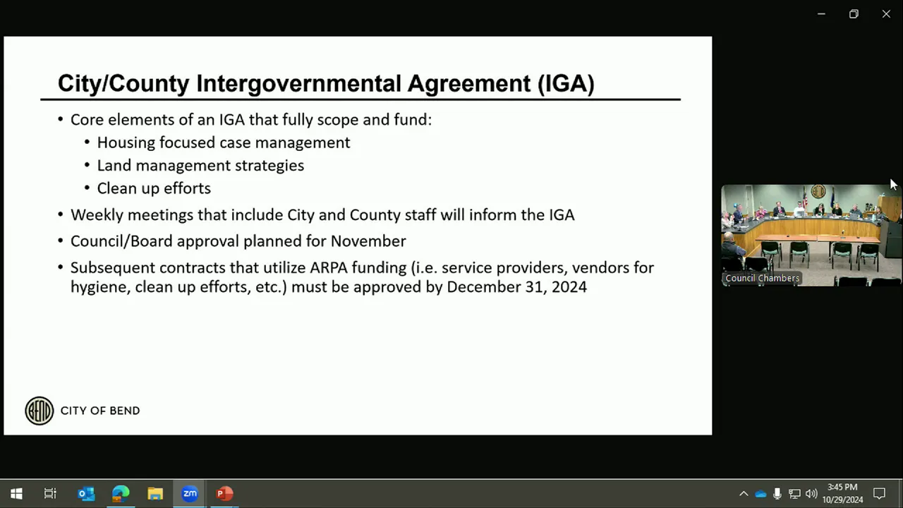
- Next steps: City staff will amend an existing intergovernmental agreement (IGA) with the county for case management funds (target return: November 20 meeting), establish a homeless grant program (November 6), and develop land management MOUs for operational details.
Meeting Transcript
Okay. I'm gonna convene this special meeting of the Benn City Council. Um call to order. Every counselor is present here in person. And we just have one item to discuss, and I'll let Eric take us away on that item. Um yeah, this is uh really an item that was before you at the October sixteenth meeting, but as you'll remember, we pulled that because at that time the county board had uh a uh companion resolution and they were not able to move it forward. So Jacob, if you don't mind sharing the presentation, just a few slides to go through to mainly for the public to explain kind of where things are. So go to the very first slide. So we met as a uh joint city council county board on September fifth. And in that meeting, we talked about really Juniper Ridge being kind of the main focus. So our focus really has been on the left hand side of that screen, establishing a temporary safe stay area. This is a concept where we're taking folks that uh that are camping at Juniper Ridge, and there's you know, city owns about fifteen hundred acres. This is mainly this the area outside of the city limits where we're seeing camping occur on both city and county property. So we wanted to do is improve safety in that area, and we proposed a concept of this TSSA or temporary safe stay area that would allow folks to receive uh more housing focused case management services, provide some additional uh sanitation um services, how our hygiene sanitation services and um just and develop a land management strategy so that we had uh we improved safety for all, including some additional fire mitigation. So that was the general concept paired with that was closures of certain areas, starting with the east side of the railroad on May 31st, 2025, and then a full closure in uh the end of the funding period. So we're using American Rescue Plan Act or ARPA dollars, the funding that is intended for this the case management services and some of the other uh other support services are all all is due to expire at the end of 2026. So that's the the timeline here. Just to note the CHRO coordination. What we would like to see is really this idea of uh working collaboratively to address this issue there. But I think the the vision is to apply this in other areas, apply this in China Hat, apply this up you know, with our partners up in Redmond to you know try to meet people where they're at, increase safety, increase services, but ultimately you know help provide more uh temporary and permanent housing solutions for folks that are uh currently living in the living outdoors. I think there's and some of those solutions are you know, meeting people where they're at right now through this, but then establishing maybe more structured managed camps or other safe parking programs, one of which is the Gales property that's been talked about too. So that's something for the CHRO to continue to explore. Move to the next. So there's really two uh components to this work. There's the land management strategy, uh, which will just outline kind of the existing conditions and then what we're proposing to do. This resolution just kind of outlines the the process to improve how we're managing land and some of those timelines I just uh summarized, as well as the housing focus case management. So I just want to give you an outline of of both of those things. Um there'll be some subsequent actions that uh that will come in the form of IGAs, MOUs, and things that'll summarize at the end. Uh but just in terms of the the folks that are currently camping at Juniper Ridge, uh you can see the statistics up there. Most of the camps are uh currently west of the railroad tracks. There are about 20 camps that are east, um, and uh that encompasses a pretty broad area of about five 500 acres. I think the main concern is we have folks that are with between a railroad track and a canal. It's very hard if there's an incident back there, fire risk, um, just for the health and safety of those that are living there to really uh to begin closing that, and our proposal is to close it on May 31st, 2025 to move those folks uh to what is will be defined as the TSSA. Um, and you can see that the county and city own land that's west of the railroad tracks, um about a 30-70 split uh percentage-wise of the land that's owned in that area. So if you go to the next slide, um just the there are existing services that are being provided by the county. So we have signed a uh an IGA already uh that we had in play for uh reimbursing the county for those services, and we want to expand those services to uh that include wash washing stations, uh restrooms, uh trash removal, uh, those types of services. Um, and so those will be expanded, and we'll be using those IGAs as well as our own existing contracts with Central Oregon Biosolutions and other providers to just manage the land in that area. And as we represented in front of the uh both uh city and county on September 5th, the identified area that is east of the railroad tracks and uh west of highway 97 is about 170 acres. Um east of the highway 97, west of the railroad tracks, uh that's hashed there in that graphic. That was the initial proposal, again, 170 acres. The idea was also to use that crusher site number two on that blue parcel that's inside the current urban growth boundary, that would be for storage. Uh so property that needed to be removed uh would be stored there for um you know the state requirements along around uh keeping um personal property for 30 days. So with the uh on October 16th, these this resolution was before the county commission. Uh the county did not have the votes to move it forward, had just uh Commissioner DeBone supporting the resolution. Uh so we've kind of we re-regrouped and from that uh the uh Commissioner Chang had an alternative resolution that relied mainly on voluntary uh voluntary compliance agreement, uh which we didn't feel that provided the legal foundation to move forward, and then Commissioner Adair expressed interest in moving forward, albeit in a smaller footprint and taking that temporary safe state area from 170 acres. Initially, she had proposed 20 acres. Uh so what we did is we met as staff. If you go to the next slide and looked at that 170 acres and looked at existing camps, so those are those uh circles you see in the camps. So those are those circles you see in the camps. When you add them up, they amount to about 40 acres.
openpublica.com